
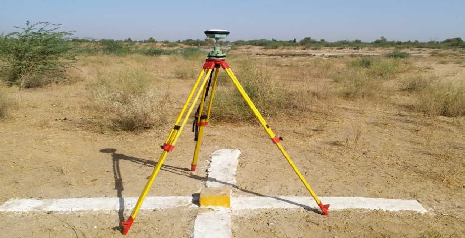
DGPS SURVEY

DGPS Survey

Introduction

A DGPS Survey (Differential Global Positioning System Survey) is an advanced surveying method that improves the accuracy of standard GPS by using a network of fixed ground-based reference stations. DGPS enhances positional accuracy to within a few centimeters, making it ideal for high-precision surveying and mapping applications.

What is DGPS?

A DGPS survey uses Differential GPS (DGPS) is a refinement of the Global Positioning System (GPS) that reduces errors caused by atmospheric conditions, satellite clock drift, and signal delays. It works by comparing signals received by a stationary base station (with a known location) and a mobile rover unit. Corrections calculated by the base station are sent in real-time to the rover, significantly increasing positional accuracy.


Key Components

  • Base Station – A fixed GPS receiver at a known location that calculates correction data.

  • Rover – A mobile GPS receiver that moves around the survey area and applies the corrections.

  • Radio Link or GSM Modem – Transmits correction signals from the base to the rover.

  • Controller/Data Collector – Logs coordinates and stores data.

  • Software – Used for post-processing and mapping.


Surveying Procedure

  1. Setup Base Station – Install the base station over a known control point.

  2. Initialize Rover – Connect and configure the rover to receive real-time corrections.

  3. Data Collection – Move the rover to different survey points and record accurate coordinates.

  4. Post-Processing (if required) – Apply corrections in software to further refine accuracy.

  5. Data Export – Extract and format data for use in CAD, GIS, or other mapping systems.


Applications

  • Topographic and cadastral mapping

  • Road and railway alignment

  • Utility mapping and infrastructure surveys

  • Coastal and marine navigation

  • Precision agriculture

  • Mining and quarrying


Advantages

  • High positional accuracy (sub-meter to centimeter level)

  • Real-time corrections for immediate results

  • Works in remote or open areas where traditional methods are difficult

  • Efficient data collection over large areas

  • Compatible with GIS and CAD software for seamless integration


Conclusion

DGPS Surveying is a powerful and precise technique for capturing geospatial data with high accuracy. Its ability to provide real-time corrected positioning makes it a go-to method for many modern surveying tasks, especially where accuracy and efficiency are critical.

Scroll to Top